


 Download(3.04MB)
 1.0.0.6.7
 4.34MB
7.1
To help the workers of the sky!
To help the workers of the sky!
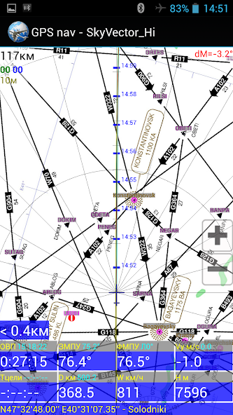
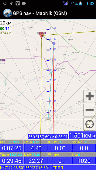
- Aviation GPS Navigation;
- GPS Landing.
- Calculations Using GPS Data.
- Calculation of the Flight Route (IHR) According to the weather forecast.
- Other Aviation Calculations;
- Time Calculator;
- View the TAF / METAR / NOTAM REPORTS OF INTERNATIONAL AIRPORTS AND DECODE Them;
- Viewing of Area Weather Forecasts.
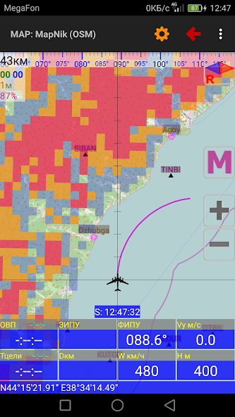
- Loading and viewing of Weather Maps, Weather Section Along The Route, Meteor Radar and Satellite images;
Help file to the program: http://navair.narod.ru/download/pronebo_help.pdf.
Discussion at forumavia: http://www.forumavia.ru/a.php?a=t&id=13080.
Discussion at 4PDA: http://4pda.ru/forum/index.php?showtopic=382528.
Group VC: https://vk.com/club159833375
 Similarity
January 21, 2026
January 21, 2026
January 21, 2026
January 21, 2026
January 20, 2026
January 20, 2026
January 20, 2026
January 19, 2026
January 19, 2026
January 19, 2026
January 19, 2026
January 18, 2026